← All projectsDESIGN IN DETAIL / P134

Planning a city-scale game map.

A legible plan before a larger environment.

Explore the story
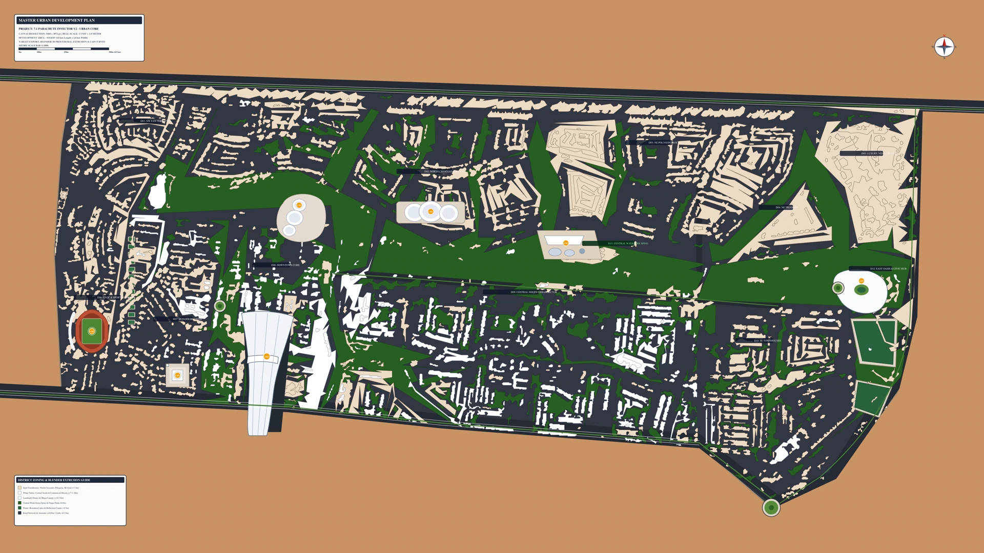
Annotated top-down game-city plan with dense pale building footprints, dark roads, a central green corridor and landmark zones.
A top-view planning export organizes dense urban districts around a green central corridor, perimeter roads and landmark zones.
01 / THE IDEA

A closer
look.

Organize urban districts, movement and landmarks into a useful scene-planning image.

02 / DESIGN APPROACH

From intention
to experience.

Contrasting fills separate buildings, roads and open space around a central green corridor. District labels and a legend support the top-view plan, with SVG attributes carrying additional terrain information.

01

Contrasting terrain fills

The 1920 by 1080 image presents a complete irregular site boundary, perimeter highways, many pale building footprints and a broad green central corridor.

02

Central green corridor

The existing map export uses contrasting fills to separate building fabric, roads, open space and landmark footprints.

03

District labels and legend

District labels and a legend make the plan readable as both a visual composition and a guide for later scene construction.

03 / THE VISUAL STORY

The work,
in full.

Explore the complete compositions and interface states. Select any image for a closer look.

VIEW 01 / 01

Opening view

Annotated top-down game-city plan with dense pale building footprints, dark roads, a central green corridor and landmark zones.

Annotated top-down game-city plan with dense pale building footprints, dark roads, a central green corridor and landmark zones.
A top-view planning export organizes dense urban districts around a green central corridor, perimeter roads and landmark zones.
04 / THE DETAILS

What brings
it together.

Structure, interaction and visual decisions that give the work its character.

Design decisions

  • Contrasting terrain fills
  • Central green corridor
  • District labels and legend

Project components

  • Vector artwork and screen layouts
  • Documented production workflow
  • Scene composition views
Production notes & credits

RoleContribution awaiting confirmation

AssetsPrivate evidence draft. Individual contribution and public use remain unverified. Source files do not establish personal authorship, original modeling or original illustration. Supplied, licensed, upstream and AI-assisted components require separate credit. Reference-derived planning study; preserve upstream map/reference and game-tool credits. Diagram annotations are source design labels, not independently verified engineering or delivery claims.

StatusPrivate evidence draft; contribution and final delivery unverified

Image notes

  • A top-view planning export organizes dense urban districts around a green central corridor, perimeter roads and landmark zones.
  • Private evidence draft. Individual contribution and public use remain unverified. Source files do not establish personal authorship, original modeling or original illustration. Supplied, licensed, upstream and AI-assisted components require separate credit. Reference-derived planning study; preserve upstream map/reference and game-tool credits. Diagram annotations are source design labels, not independently verified engineering or delivery claims.
HAVE SOMETHING IN MIND?Let’s make it
an experience.